Don't Put This Lower On The List - Lower Calf Creek Falls is one of Southern Utah's Top Hikes
- Dustin Cook
- Nov 14, 2020
- 3 min read
Updated: Mar 2, 2021

If you are looking for a beautiful hike that has a little bit of everything, look no further. Lower Calf Creek Falls is just over 6 miles out and back, but don't let the distance scare you - the hike is relatively flat and offers plenty to see all along the way including ancient granaries, petroglyphs, a diverse collection of plant life and of course a beautiful falls and swimming hole at the end.

Getting Here
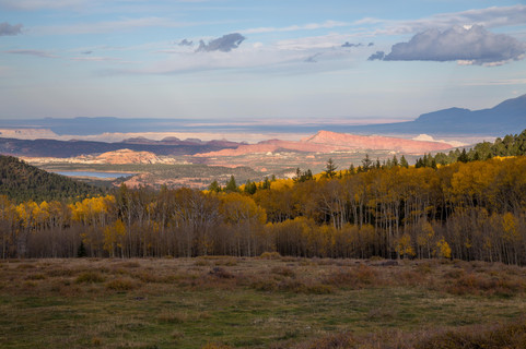
Lower Calf Creek Falls is located on Highway 12, about 15 miles North of Escalante Utah. Highway 12 is a scenic byway and provides some great scenery including Boulder Mountain, Hogsback and Hell's Backbone. The turnoff to the Lower Calf Creek Recreation area is well marked with signs. There is a big parking lot, restrooms as well as some camp sites. If you plan on camping at Calf Creek, however, be sure to arrive early as campsites are on a first come first serve basis, and often fill up in the morning during peak season. Water is available at the trailhead and you'll want to be sure to bring plenty of water with you on the trail, especially if hiking in the summer.

The Trail
The trail head begins just a hundred yards or so down the paved road from the parking lot. The trail is well marked and meanders its way through the sandstone canyon just above calf creek. The trail is mostly flat with just a few rollers as you ascend and descend to the creek along the trail.

A trail guide is available at the trailhead that points out some interesting spots along the way. You'll notice along the trail there are posts with numbers on them, these mark interesting sites such as an ancient granaries, petroglyphs and unique plant life. Information about these can be found in the trail guide. After hiking for just over three miles you will reach your destination.

The Falls
Lower Calf Creek Falls is 126 feet and falls from the canyon above into a pool, which then flows down the canyon. There is no path beyond this point and trying to climb above the falls is nearly impossible. There is an upper calf creek falls above lower falls that is only accessible from a trail on highway 12.

Trees and plants surround the falls and make for a great spot for lunch or a snack. The water in the pool is quite cool, but still good for a swim on a hot day. There are also a few stronger trees for setting up a hammock. The area around the falls is beautiful and comfortable and it is easy to spend an hour or more enjoying the beauty and peace of the falls. While it can be a busy trail in summer, the space below the falls is quite large and rarely feels crowded. With the orientation of the canyon, the falls gets sun early in the morning to midday and is completely shaded by the early afternoon.

The hike can be done in a morning or an afternoon, with plenty of time to spend at the falls.
Lower Calf Creek falls can also be hiked from a parking lot above on Highway 12 near the part of the highway known as Hogsback. While this trail to the falls is shorter, it is quite steep and completely exposed to the sun. The trail leads to both the upper falls and lower falls, but requires some scrambling to get to the Lower Falls. You also don't get the great views and scenery by taking the main trail through the canyon. It's definitely not the best way to go, but is expedient if you are in a hurry. Look for a later post on this route.
While Lower Calf Creek is a destination hike there are also some other areas to check out nearby including Upper Calf Creek Falls, Hell's Backbone, Boulder Mountain, Escalante or a little bit further is the Burr Trail to Capital Reef National Park (4x4 is advised for this trail.) If you are looking for a good place to eat after the hike I recommend the Burr Trail Grill in Boulder or Hell's Backbone Grill, they have some locally sourced dishes including some unbelievable burgers and some of the best pie you'll ever eat.
If you found this article helpful and are planning other adventures in Utah consider signing up for our e-mail list (simply go to the top of page and click subscribe - it's free!) to get the latest adventure posts. You can also sign up to be a member here to share comments at the bottom of our posts and in our forums. Most importantly don't forget to get outside and find your adventure!


Comentarios